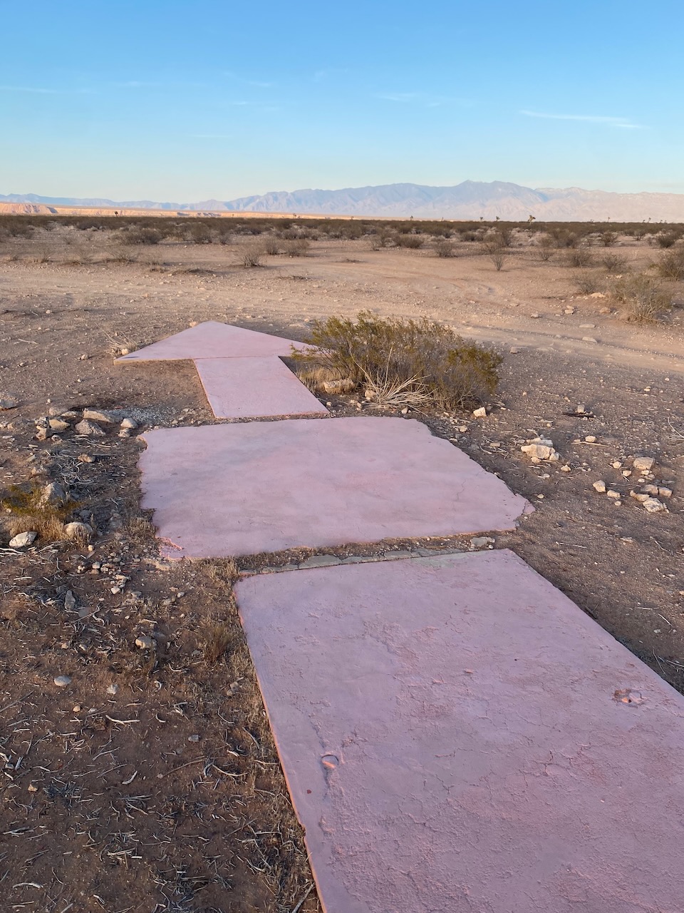
Sunday Drive - Mesquite's Aviation Arrow

Our Sunday Drive this week features another aviation beacon. We’ve mentioned all the arrows in Washington County before but there’s another beacon close by, just a few miles over the border in Nevada.
Back in the 1920s, in order to help airmail pilots navigate across the county, a series of beacons were built by the Postal Service stretching from San Fransisco and Los Angeles to New York. Four of the concrete arrows that helped pilots navigate from LA to Salt Lake City are still in existence here in southern Utah and a fifth, our featured drive this week, is just a few miles outside of the state, atop Mormon Mesa west of Mesquite.
The Mormon Mesa arrow formed the base of Beacon 32, located in the open desert a few miles east of the truck parking area at mile marker 111 on Interstate 15 just south of the Riverside and Bunkerville Exit.
To get there, simply take the dirt road that angles up to the northeast from the truck parking area. The easiest way to make sure you’re on the right road is to plug the GPS coordinates into your phone. Here’s a link to the arrow on Google Maps: https://goo.gl/maps/wzxxiHiU4wMFgRNy8
Originally, these concrete arrows each had 51-foot tall steel towers with one-million candlepower, rotating beacons standing atop them in order to allow night-time navigation. But when the arrows were decommissioned in the 1940s the steel was often recycled to be used in the war effort.
The Beacon 32 arrow can be reached without much of a hike but the road up to it is rough and rocky. High clearance is recommended but it can be reached without four-wheel drive.
You can read more about Beacon 32 and see more pictures of the arrow at http://www.dreamsmithphotos.com/arrow/States/nv/04_32_nv_mormon_mesa.html
Even if there weren’t an amazing relic of aviation history located at the site, the views from Beacon 32 are worth the effort it takes to get there.
There are four other aviation arrows located in Washington County, one on the ridge overlooking Quail Creek, another on the ridge overlooking the Virgin River and Bloomington just south of the Stephen Wade Auto Center, a third is atop the Shinob Kibe mesa in Washington City, and the fourth is just off the Black Ridge Exit on I-15. Visiting each requires serious four wheel-drive capabilities or a hike of some degree or another.
For more information on the arrow and GPS coordinates to find Beacon 32 and the other arrows exact locations, and to learn more about the beacons still left throughout the United States visit http://www.dreamsmithphotos.com/arrow/index.html You can also read more about the beacons in Washington County at the Washington County Historical Society’s website at https://wchsutah.org/aviation/navigation-arrows.php

